Transforming Existing Conditions Surveying: AJA Architecture and Planning’s Cutting-Edge 3D Scanning Services
Capturing Existing Conditions: The Art and Science Behind Every Project
At AJA Architecture and Planning, documenting existing conditions isn’t just about measurements and data points. It’s about understanding a space—its history, its quirks, its challenges. Every project, from a historic hotel in Lake Placid to a sprawling Montana ranch, demands precision, adaptability, and a deep respect for the environment we’re working within.
We’ve spent long days in the field, battling subzero temperatures, trudging through deep snow, and troubleshooting technology in real-time. But we’ve learned something along the way: successful 3D scanning isn’t just about having cutting-edge tools—it’s about knowing how to use them in unpredictable, real-world conditions.
Trial by Snow: The Summit Hotel, Lake Placid
One of our most demanding assignments was capturing the existing conditions of the Summit Hotel in Lake Placid, now transformed into the Bluebird Hotel by Lark. This was no simple site visit—it was an exhaustive, multi-day operation requiring 3D scanning, detailed photography, and traditional surveying.
I made the trip with one of our architectural designers, Patrick Kniskern. From early morning until long past sunset, we worked tirelessly to document every inch of the building. But the biggest challenge? The weather.
- Subzero temperatures made exterior scans physically brutal and drained batteries faster than we could swap them.
- Deep snow made access difficult, slowing our progress between scans.
- Low light conditions in certain rooms meant supplemental flood lights were essential.
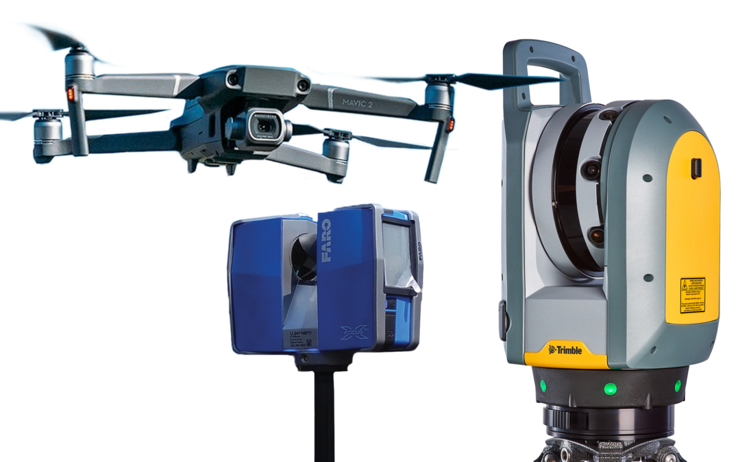
- Older scanning tech lacked real-time stitching, meaning any missing data would have been discovered too late. Luckily, our Trimble X7 scanners with T10x tablets allowed us to review scans in real time, ensuring we didn’t leave with gaps in the data.
Despite the brutal conditions, we walked away with a near-perfect digital model, accurate to within ±5mm. That level of precision meant our design team—many of whom never set foot in the building—could work confidently from a digital twin of the space. In projects like these, accuracy saves time, money, and countless headaches.

Capturing a Montana Ranch: A Different Kind of Challenge
If Lake Placid tested our endurance, our trip to White Sulphur Springs, Montana, tested our organization. At the Rocking C’s Ranch, we weren’t dealing with one large structure but multiple buildings spread across a vast property—a skeet shooting facility, several cabins, barns, and various outbuildings, each requiring meticulous documentation.
This project reinforced one of the biggest lessons in surveying: organization is everything.
- Each structure needed its own dedicated scans, photos, and notes to ensure clarity.
- Proper file naming and categorization were crucial—our designers in Glens Falls had never been on-site, so they relied entirely on our documentation.
- Every window, door, and roof condition had to be noted for future improvements.
Without a hyper-organized approach, details could have been lost, making design coordination far more difficult. This project highlighted the importance of treating every structure individually while maintaining a holistic view of the entire site.

Lessons from the Field: What Makes a Successful Survey?
After countless projects, one truth remains: surveying is as much about process as it is about technology. The difference between a smooth project and a logistical nightmare often comes down to the little things:
Equipment Maintenance – Cold weather kills batteries, and scanners need light to function properly. Always carry backups.
File Organization – Properly labeling and structuring scans, images, and reports prevents chaos later.
Clear Workflow Plans – Breaking projects down into interior/exterior and room-by-room divisions creates efficiency.
Adapting to Environmental Conditions – Weather, lighting, and site hazards can all impact accuracy—being prepared makes all the difference.
Technology Matters, But So Does Skill – Even with the best tech, scanning is an art. Knowing when to rescan and how to position reference points takes experience.

The Future of Surveying: Where We’re Headed
Surveying has evolved dramatically, but we’re only scratching the surface of what’s possible. AI, augmented reality (AR), and virtual reality (VR) are set to change how we document and visualize existing spaces.
At AJA, we’re actively working toward integrating these technologies, allowing clients to virtually explore their spaces before a single design decision is made. Not everyone can visualize a space in 3D, but with the right tools, we can bridge that gap—transforming raw data into interactive, immersive experiences.
Because at the end of the day, surveying isn’t just about capturing reality—it’s about bringing it to life.

Final Thoughts
From a snow-covered hotel in Lake Placid to a remote Montana ranch, every project has taught us something new. No two jobs are alike, and each presents unique challenges that demand problem-solving, adaptability, and an obsessive attention to detail.
By refining our workflows, embracing new technology, and learning from every experience, we’re not just documenting spaces—we’re transforming the way architecture and planning are done.