Existing Conditions Surveying
In the ever-evolving world of architecture and planning, staying ahead of the curve is crucial. At AJA Architecture and Planning, we pride ourselves on leveraging the latest technological advancements to provide unparalleled service and expertise. Our 3D Scanning and Drone Services embody our commitment to innovation and delivering exceptional value. These services not only enhance the accuracy and efficiency of our projects but also bring immense value to our clients.
The Foundation for Success
At AJA, we utilize our 3D Scanning, Scan Compilation, and Drone Services to create thorough existing conditions documents in Autodesk Revit and Graphisoft Archicad. These documents serve as an essential starting point for any project, ensuring that every detail is accounted for.
Delivering Value Through Documentation
- Record Accuracy: Precise existing conditions documentation helps avoid costly errors and extra work.
- Project Initiation: Detailed records provide a solid foundation for new projects, facilitating smoother transitions from planning to execution.
- Versatile Formats: We deliver files in PDF (.pdf), (.dwg) formats, or others as requested, making them easily accessible and usable in various stages of the project.

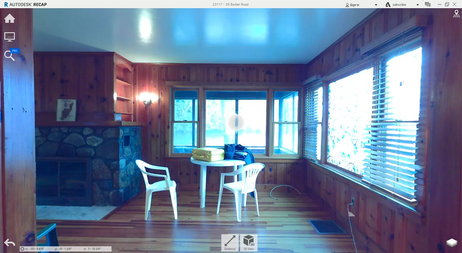
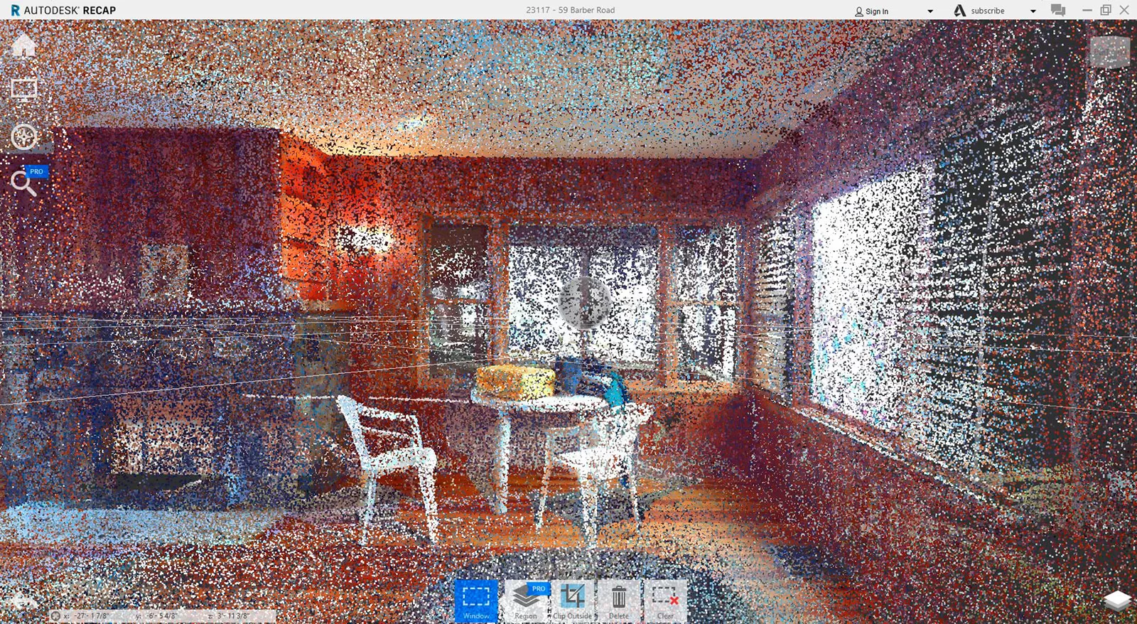
3D Point Cloud Scanning: Precision at Its Best
What is 3D Point Cloud Scanning?
3D point cloud scanning works by using a laser scanner, utilizing LiDAR (Light Detection and Ranging) technology, to emit laser pulses toward a surface, then measuring the time it takes for the reflected pulses to return, which calculates the distance to each point on the surface; this creates a massive collection of 3D coordinates (X, Y, Z) called a “point cloud” that represents the detailed 3D shape of the scanned object or area.
How Does It Benefit Your Project?
- Accurate Documentation: Whether you’re looking to document existing structures or embark on new construction, 3D scanning provides precise measurements that minimize errors and discrepancies.
- Enhanced Visualization: We use the point cloud data to create detailed models, enabling our clients to visualize spaces in three dimensions.
- Efficient Planning: Accurate scans streamline the planning process, reducing the time and cost associated with manual measurements.
Our 3D point cloud files (.fls) are available for digital download, ensuring seamless integration with your project’s workflow.

Drone Services: A Bird’s Eye View
Exploring the Capabilities of Drone Technology
Drones have revolutionized the way we gather information about our surroundings. At AJA, we utilize drones for a variety of purposes, from capturing still images and videos to conducting thorough investigations of hard-to-reach areas like rooftops.
Why Choose Drone Services?
- Comprehensive Site Analysis: Drones provide an aerial perspective, offering a complete view of the site that ground-based inspections cannot match.
- Safety and Accessibility: Inspecting high or hazardous areas is safer and more efficient with drones, eliminating the need for scaffolding or ladders.
- Detailed Documentation: High-resolution images (.jpeg) and videos (.mp4) captured by our drones ensure that no detail is overlooked, aiding in accurate record-keeping and analysis.
All files are provided via digital download, tailored to meet the specific requirements of your project.

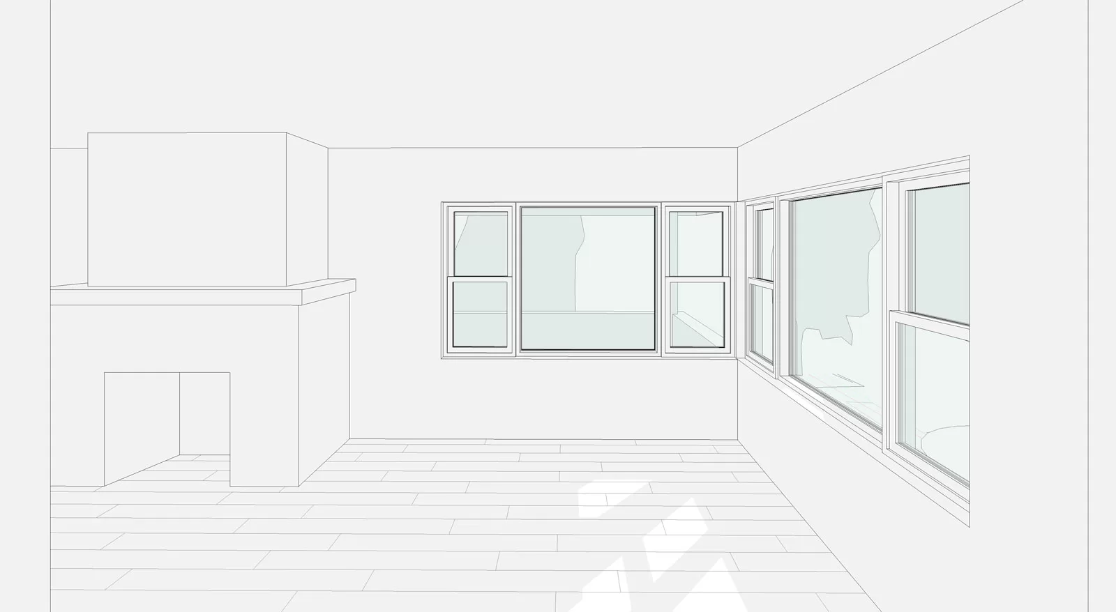
3D Scan Compilation: Integrating Data for Seamless Modeling
The Power of 3D Scanning Technology
To maximize the utility of our 3D scans, AJA uses 3D modeling programs such as Autodesk Recap to compile point cloud data into cohesive models. This process involves stitching together individual scans to create a comprehensive digital representation of the space.
Applications and Advantages
- As-Built Conditions: The compiled scans offer an exact digital twin of the physical environment, ideal for renovations or expansions.
- Enhanced Design: These models serve as a foundation for creating detailed designs in Revit, AutoCAD, or Archicad, facilitating precise and informed architectural planning.
- Interactive Walkthroughs: Experience the space virtually with walkthrough models, providing an immersive understanding of the project.
All files are provided via digital download, tailored to meet the specific requirements of your project.
Experience the AJA Advantage
Our commitment to integrating cutting-edge technology with architectural expertise sets AJA Architecture and Planning apart. By offering 3D Scanning and Drone Services, we aim to provide our clients with the highest level of precision, efficiency, and value. Explore the future of architecture with us and see how these innovative services can transform your project.
By adopting these advanced services, AJA Architecture and Planning continues to redefine industry standards, ensuring that our clients receive the best in accuracy, efficiency, and innovative solutions. Trust us to bring your vision to life with the precision and professionalism that AJA provides.